The Reykjanes peninsula awakens: the series of eruptions that has changed southern Iceland
After eight centuries of calm, the Reykjanes peninsula has been erupting since 2021 and, above all, since December 2023 near Grindavík. We explain the phenomenon and how to travel safely.
Iceland sits on the Mid-Atlantic Ridge, where the North American and Eurasian plates are pulling apart by about two centimetres a year. That separation opens cracks, and magma sometimes rises through them. For around 800 years, the Reykjanes peninsula, in the south-west of the island and very close to Keflavík international airport, stayed quiet. In 2021 it woke up.
From Fagradalsfjall to Grindavík
The first eruptions of the new cycle (2021, 2022 and 2023) took place in the Fagradalsfjall area, in uninhabited valleys. They became an accessible spectacle and thousands of people hiked out to see them.
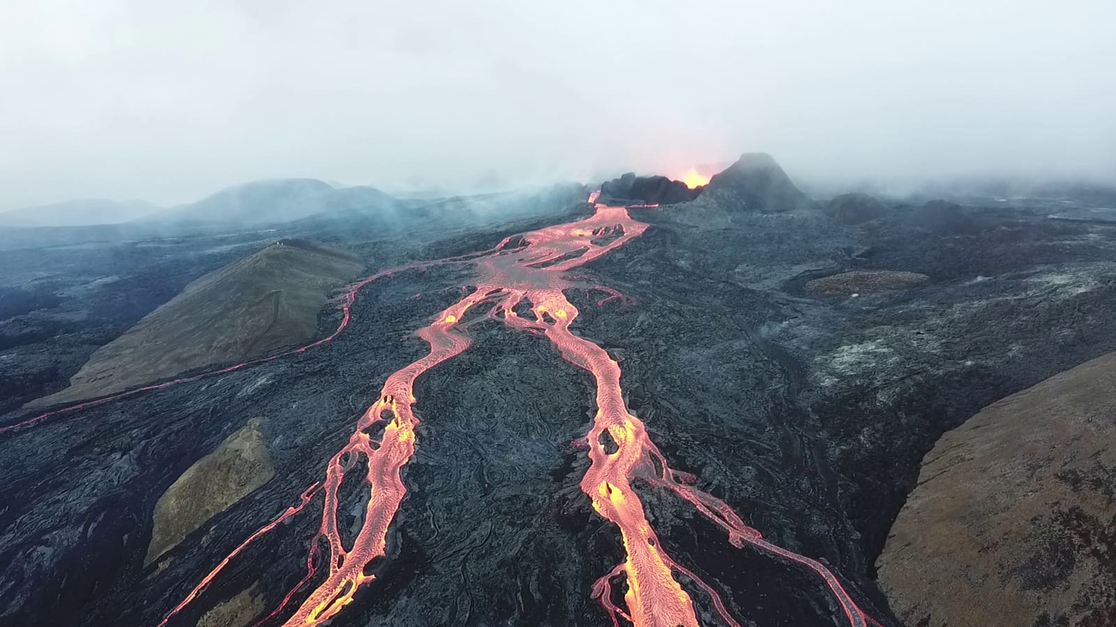
Things changed at the end of 2023. In November, an intense earthquake swarm and the formation of a magma dyke beneath the fishing town of Grindavík forced the evacuation of its nearly 4,000 residents. Since December 2023, the Sundhnúkur crater row, north of the town, has seen a succession of fissure eruptions.
Some lava flows reached the outskirts of Grindavík and destroyed several homes; others cut roads and hot-water pipelines. The authorities built earth and rock barriers to divert the lava away from the town, the Svartsengi geothermal power plant and the famous Blue Lagoon spa.
What a fissure eruption is like
Unlike cone-shaped volcanoes, here lava pours out along fissures that can be several kilometres long, forming so-called “curtains of fire”. They tend to be:
- Effusive, with lava flows rather than explosions.
- Intense at first, with flow rates that decrease within hours or days.
- Preceded by warning signs: ground deformation and earthquakes, which Iceland’s monitoring network detects.
That does not make them harmless. The main dangers are the lava flows, new fissures opening suddenly, cracks in the ground and, above all, volcanic gases, which can build up in low-lying areas.
In a fissure eruption, the danger is not always visible: gases can concentrate in hollows without warning.
If you travel to Iceland
The Reykjanes eruptions have had a very limited effect on air traffic, because they do not produce large ash clouds. Even so, plan with official information:
- Check the hazard map from the Icelandic Meteorological Office (IMO) and civil protection alerts before you go.
- Respect closures. Restricted zones are closed for safety reasons, even if everything looks calm from a distance.
- Do not walk on fresh lava: it can be hollow, unstable and very hot beneath the surface.
- Watch the wind and the gases. Stay upwind and move away if you notice a strong smell, irritation or difficulty breathing.
- Register your route with Safetravel if you go hiking outside the usual areas.
A cycle that could last decades
Volcanologists believe Reykjanes has entered an eruptive period that, judging by the peninsula’s geological history, could last years or decades, with phases of activity and calm. It is not possible to predict exactly when and where each eruption will happen, but it is possible to detect the warning signs early enough to evacuate.
Iceland is one of the best places in the world to understand that the landscape is alive. If the island interests you, see our fact sheet on the Laugavegur trek, which crosses spectacular volcanic terrain, or our selection of natural phenomena you can see with your own eyes.
Sources and references
This is original editorial content based on the sources cited. Spotted a mistake? Let us know and we will fix it under our corrections policy.