How to navigate in the mountains when you have no signal and no GPS
Your phone runs out of battery, the signal disappears or the GPS goes haywire in a deep valley. These are the navigation techniques that really work when technology fails.
Technology has made it easier than ever to find your way in the mountains. It has also meant many people do not know how when it fails. And it does fail: batteries die in the cold, phones get wet, valleys have no signal or a track does not match what you see. This guide sums up the techniques that work without electronics, from most to least useful.
First: prevention
Good navigation starts at home:
- Download the map of the area in an app that works offline and carry a paper map if the route is long or little used.
- Study the route: which valleys you cross, which rivers you follow, where the key junctions are, which summits you will see on each side.
- Identify a “safety line”: a river, a track or a big road you could reach if you get disoriented.
- Save battery: airplane mode, low brightness and a power bank.
An important detail: phone GPS works without signal, because it receives signals from satellites. What will not work is downloading maps at that moment.
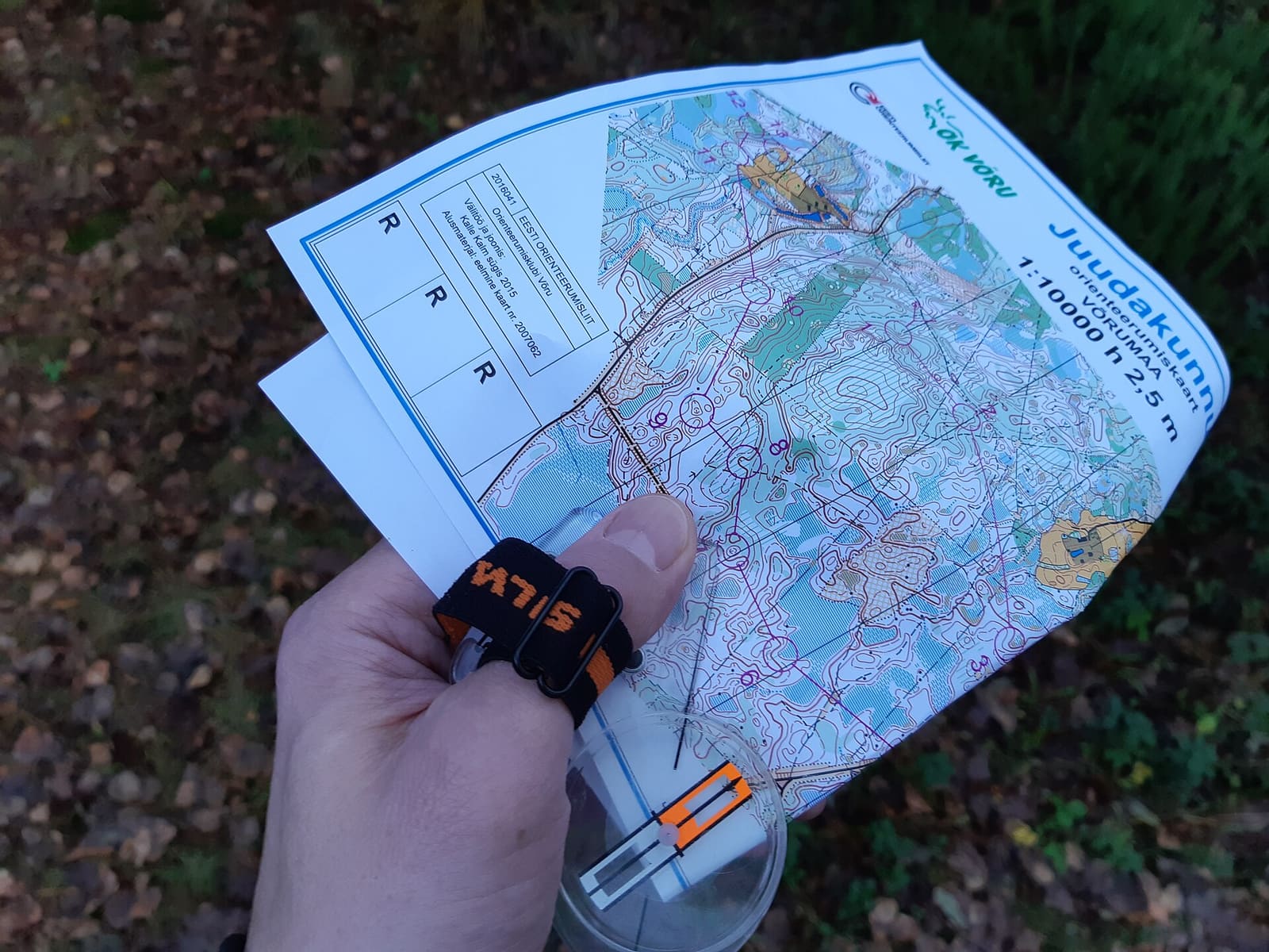
1. Reading a topographic map
The map is your main tool. The essentials:
- Contour lines: lines joining points at the same altitude. Close together = steep slope; far apart = gentle ground.
- Landforms: a “V” or “U” of contours pointing uphill indicates a valley or gully; pointing downhill, a ridge or spur.
- Scale: on a 1:25,000 map, 1 cm equals 250 m.
- Setting the map: turn it so that what you see on the map matches what you see on the ground. A summit on your left should be on the left of the map.
You can set the map without a compass: identify two clear features in the landscape (a peak, a lake) and turn the map until they line up.
2. Using a compass
A compass points to magnetic north, which does not exactly match the map’s true north. The difference is called magnetic declination and varies with place and year (check its value on the map or with official calculators). In much of Western Europe it is small, but in other parts of the world it can be many degrees.
Basic uses:
- Setting the map: place the compass on the map and turn the map until map north and the needle line up (correcting for declination if it is significant).
- Following a bearing: point the compass’s direction-of-travel arrow towards your destination on the map, turn the bezel until its lines align with map north and then, on the ground, turn yourself until the needle sits inside the orienting arrow. The direction-of-travel arrow shows your bearing.
- Walking on a bearing in fog: pick a nearby point in that direction (a rock, a bush), walk to it and repeat.
Learning this takes practice: do it in a park or on a familiar route before you need it.
3. The sun
Without a compass, the sun gives you a rough direction:
- It rises roughly in the east and sets in the west (with seasonal variations).
- In the northern hemisphere, around solar noon the sun is roughly due south. In the southern hemisphere, due north.
- Note: solar noon is not 12:00 on the clock. In mainland Spain, for example, it happens around 14:00 in summer time.
Analogue watch method (northern hemisphere): point the hour hand at the sun; the line halfway between that hand and 12 (or 1 in summer time) points roughly south. It is an approximation, less reliable near the equator.
4. The stars
- Northern hemisphere: the North Star (Polaris) marks almost exactly north. To find it, extend the line between the two end stars of the Big Dipper’s “pan” about five times.
- Southern hemisphere: the Southern Cross lets you estimate south by extending its long axis about four and a half times.
5. Terrain and water
In the mountains, the terrain is often the best compass:
- Rivers flow downhill and usually lead to inhabited valleys, although sometimes through dangerous gorges: do not follow a stream down vertical terrain.
- Ridges and crests connect summits; passes are natural crossings.
- Retracing your steps to the last known point is usually safer than looking for shortcuts.
Myths to forget
- Moss does not reliably indicate north.
- Anthills, the shape of tree crowns or snow on one slope may give you local clues, but they do not work as a general method.
If, despite everything, you become disoriented, the priority is not finding the path but not making things worse. We explain it in what to do if you get lost in the mountains.
Frequently asked questions
Does phone GPS work without signal?
Yes. GPS receives signals from satellites and does not need mobile coverage. What you do need is to have downloaded the map and route beforehand to use them offline, and battery.
Is it true that moss grows on the north side of trees?
It is not reliable. Moss grows where there is more moisture and shade, which depends on the terrain, nearby vegetation and the wind. It can appear on any side.
Sources and references
- Spanish National Geographic Institute (IGN) – Mapping
- FEDME – Navigation training
- NOAA – Magnetic declination calculator
This is original editorial content based on the sources cited. Spotted a mistake? Let us know and we will fix it under our corrections policy.